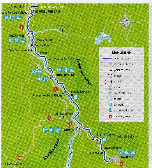
Clutha Gold Trail – 73km
Lawrence to Lake Roxburgh Dam
This is an excellent cycle trail which is completely traffic free and with no significant hills to be negotiated although the trail does involve a total ascent of 1,500 feet which is spread evenly over the distance.
On the day that I cycled it there weren’t even any other cyclists – solitude can be one of the many attractions of cycling.
The trail is a well maintained gravel path with kilometre posts along its length and there are no navigation issues. It also has very informative panels every few kilometres telling you about the history of the people and the land.
It passes through three townships offering refreshments and accommodation. These are Beaumont, Millers Flat and Roxburgh. Lawrence, where the trail starts, also has accommodation and refreshments. At the height of the gold rush Lawrence was bigger than Dunedin with about 11,000 inhabitants of whom only 140 were women.
Many of the prospectors were from overseas and two early settlers were George and Helen Munro from Scotland who set up home north of Lawrence around 1850. They lived in a house with a mud floor and their nearest neighbours were 56 km away which begs the question “how bad was Scotland?” Apparently Mrs Munro went for two years without speaking to another woman but she was resourceful and found gold with just kitchen tools and became the first female gold prospector.
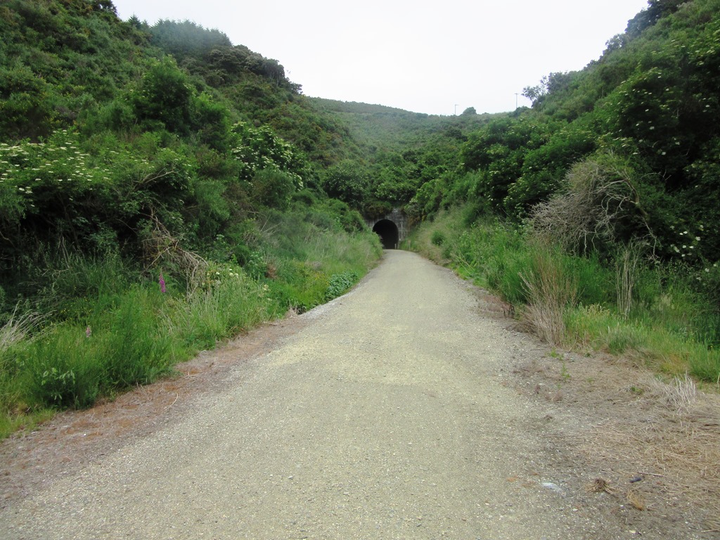
Big Hill Tunnel entrance
The track from Lawrence to Beaumont follows the line of a railway track built in the late 1800’s from Dunedin to Beaumont. This avoids Big Hill by using a 440 metre long tunnel created using pick and shovel and explosive. The Big Hill Tunnel sounds like something from an Enid Blyton Famous Five book but with no lights in the tunnel and no lights on my bike it was a daunting experience. I walked through because I had no sense of balance with only a pin point of light in the distance to give me hope of getting out the other end.
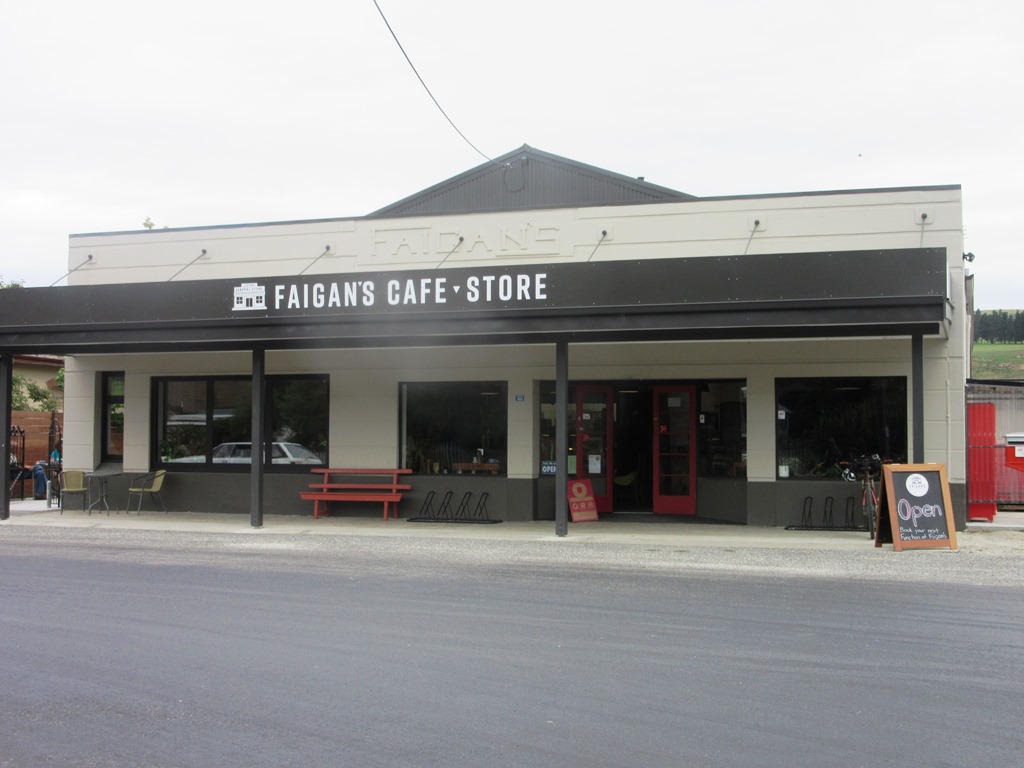
Beaumont to Millers Flat is a scenic ride as the trail follows the river closely. I stopped for lunch at Faigan’s café which sits on the trail just at the bridge over to the main highway. There is a hotel at the other side of the bridge but that is about all there is to Millers Flat.
The trail continues to hug the river to Roxburgh and along the way passes a rock in the river which is called Dumbarton Rock. It is quite a bit smaller than the rock with the same name that sits in the River Clyde but is another reminder of the many connections between NZ and Scotland.
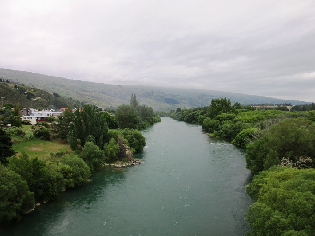
The Clutha River at Roxburgh with the remains of a previous bridge just visible on the left bank
When you reach Beaumont the trail joins the bank of the Clutha River. The Clutha is the longest river in the South Island and runs from Lake Wanaka to the Pacific Ocean at Balclutha. The Clutha is deep and wide and turbulent at many places and its emerald green waters have proved difficult to ford over the years and many bridges have been built and swept away at different points. Gold prospectors would live in tents along its banks enduring harsh winters to try to find gold by sluicing the gravel from the river. Dredge boats were built to do the job on a grand scale and the wrecks of some can still be found in the river.
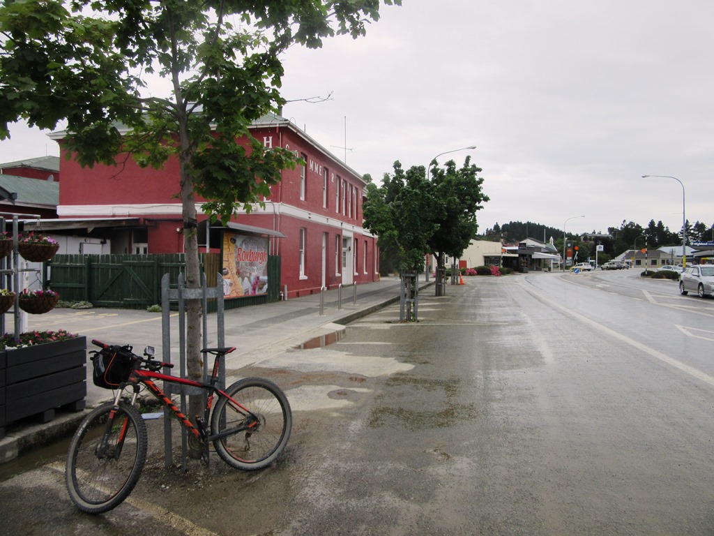
Roxburgh Main Street
Roxburgh was still trying to clear up after flash floods had washed away drains and sewers and other infrastructure and the main street where I visited the local café, was quite deserted. The last 9 km takes the trail to a car park just short of the hydro electric station on Roxburgh Lake. The ride took 7 hours in total with plenty of stops to take pictures, read the information boards, admire the views and have coffee in Millers Flat and Roxburgh.
The video below has some images of the route
ronnie@outandaboutinscotland.co.uk 5th of December 2017